
Fire River topographic map
Click on the map to display elevation.
About this map
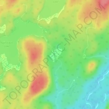
Name: Fire River topographic map, elevation, terrain.
Average elevation: 1,309 ft
Minimum elevation: 1,194 ft
Maximum elevation: 1,434 ft
Other topographic maps
Click on a map to view its topography, its elevation and its terrain.
Moccasin Lake
Canada > Ontario > Algoma District > Unorganized North Algoma
Average elevation: 1,565 ft
Clayton Lake
Canada > Ontario > Algoma District > Unorganized North Algoma
Average elevation: 1,250 ft
Batchawana Bay
Canada > Ontario > Algoma District > Unorganized North Algoma
Average elevation: 650 ft
Kabinakagami Lake
Canada > Ontario > Algoma District > Unorganized North Algoma
Average elevation: 1,089 ft
Kirkpatrick Lake
Canada > Ontario > Algoma District > Unorganized North Algoma
Average elevation: 1,407 ft
Northland Lake
Canada > Ontario > Algoma District > Unorganized North Algoma
Average elevation: 1,270 ft
Manitowik Lake
Canada > Ontario > Algoma District > Unorganized North Algoma
Average elevation: 1,293 ft
Mosambik Lake
Canada > Ontario > Algoma District > Unorganized North Algoma
Average elevation: 1,191 ft
Goulais River
Canada > Ontario > Algoma District > Unorganized North Algoma
Average elevation: 1,188 ft
Agawa Canyon
Canada > Ontario > Algoma District > Unorganized North Algoma
Average elevation: 1,342 ft
Kimiwan Creek;Kimiwan Lakes
Canada > Ontario > Algoma District > Unorganized North Algoma
Average elevation: 1,450 ft
Agawa Islands
Canada > Ontario > Algoma District > Unorganized North Algoma
Average elevation: 1,030 ft
Ogidaki Mountain
Canada > Ontario > Algoma District > Unorganized North Algoma
Average elevation: 1,824 ft
Montreal River Harbour
Canada > Ontario > Algoma District > Unorganized North Algoma
Average elevation: 696 ft
Mashagama Lake
Canada > Ontario > Algoma District > Unorganized North Algoma
Average elevation: 1,503 ft
Albany Forks
Canada > Ontario > Algoma District > Unorganized North Algoma
Average elevation: 1,063 ft
Kabinakagamisis Lake
Canada > Ontario > Algoma District > Unorganized North Algoma
Average elevation: 1,063 ft
Chapleau River
Canada > Ontario > Algoma District > Unorganized North Algoma
Average elevation: 1,076 ft
Missinaibi Provincial Park
Canada > Ontario > Algoma District > Unorganized North Algoma
Average elevation: 1,152 ft
Dog Lake Narrows
Canada > Ontario > Algoma District > Unorganized North Algoma > Missanabie
Average elevation: 1,099 ft
Wakomata Lake
Canada > Ontario > Algoma District > Unorganized North Algoma
Average elevation: 1,247 ft
Alligator Point
Canada > Ontario > Algoma District > Unorganized North Algoma
Average elevation: 1,047 ft