
Caddy Lake topographic map
Click on the map to display elevation.
About this map
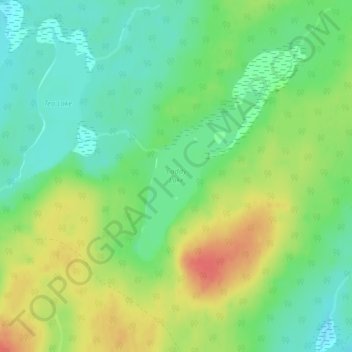
Name: Caddy Lake topographic map, elevation, terrain.
Average elevation: 1,391 ft
Minimum elevation: 1,319 ft
Maximum elevation: 1,490 ft
Other topographic maps
Click on a map to view its topography, its elevation and its terrain.
Limerick Lake
Canada > Ontario > Algoma District > Unorganized North Algoma
Average elevation: 1,657 ft
Montreal River Harbour
Canada > Ontario > Algoma District > Unorganized North Algoma
Average elevation: 696 ft
Lucille Lake;Wood Creek
Canada > Ontario > Algoma District > Unorganized North Algoma
Average elevation: 1,447 ft
Batchawana Bay
Canada > Ontario > Algoma District > Unorganized North Algoma
Average elevation: 650 ft
Seymour Lake
Canada > Ontario > Algoma District > Unorganized North Algoma
Average elevation: 1,430 ft
Agawa Canyon
Canada > Ontario > Algoma District > Unorganized North Algoma
Average elevation: 1,342 ft
Montreal River
Canada > Ontario > Algoma District > Unorganized North Algoma
Average elevation: 1,181 ft
Agawa Islands
Canada > Ontario > Algoma District > Unorganized North Algoma
Average elevation: 1,030 ft
Ogidaki Mountain
Canada > Ontario > Algoma District > Unorganized North Algoma
Average elevation: 1,824 ft
Montreal Island
Canada > Ontario > Algoma District > Unorganized North Algoma
Average elevation: 623 ft
Albany Forks
Canada > Ontario > Algoma District > Unorganized North Algoma
Average elevation: 1,063 ft
Dog Lake Narrows
Canada > Ontario > Algoma District > Unorganized North Algoma > Missanabie
Average elevation: 1,099 ft
Missinaibi Provincial Park
Canada > Ontario > Algoma District > Unorganized North Algoma
Average elevation: 1,152 ft
Dog Lake Narrows
Canada > Ontario > Algoma District > Unorganized North Algoma > Missanabie
Average elevation: 1,099 ft
Alligator Point
Canada > Ontario > Algoma District > Unorganized North Algoma
Average elevation: 1,047 ft