
Westview topographic map
Click on the map to display elevation.
About this map
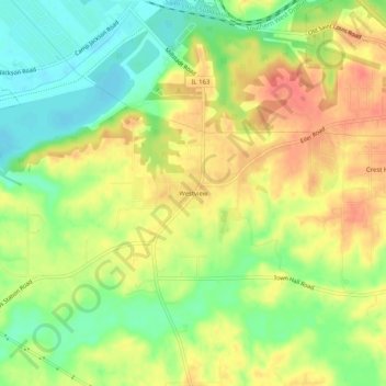
Name: Westview topographic map, elevation, terrain.
Location: Westview, Saint Clair County, Illinois, United States (38.51700 -90.12178 38.55700 -90.08178)
Average elevation: 489 ft
Minimum elevation: 397 ft
Maximum elevation: 574 ft
Saint Clair County trails, hiking, mountain biking, running and outdoor activities
Other topographic maps
Click on a map to view its topography, its elevation and its terrain.
Cahokia Mounds State Historic Site
United States > Illinois > Saint Clair County > Fairmont City
To the south of Monks Mound is the Grand Plaza, a large area that covered roughly 50 acres (20 ha) and measured over 1,600 ft (490 m) in length by over 900 ft (270 m) in width. Researchers originally thought the flat, open terrain in this area reflected Cahokia's location on the Mississippi's alluvial flood…
Average elevation: 420 ft