

Ishpatina Ridge topographic map
Click on the map to display elevation.
Ishpatina Ridge
Ishpatina Ridge is the highest point of land in the Canadian province of Ontario, at an estimated 693 m (2,274 ft) above sea level. Ishpatina Ridge rises approximately 300 m (984 ft) above the immediate area. It was only truly recognized as Ontario's highest point after topographical mapping by the Government of Canada revealed this fact in the 1970s. Before then, the more popular Maple Mountain was thought to be higher.
About this map
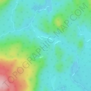
Name: Ishpatina Ridge topographic map, elevation, terrain.
Average elevation: 1,788 ft
Minimum elevation: 1,306 ft
Maximum elevation: 2,228 ft
Other topographic maps
Click on a map to view its topography, its elevation and its terrain.
Spanish River Provincial Park
Canada > Ontario > Sudbury District > Unorganized North Sudbury
Average elevation: 1,345 ft
Round Lake
Canada > Ontario > Sudbury District > Unorganized North Sudbury
Average elevation: 1,289 ft
Tatachikapika Lake
Canada > Ontario > Sudbury District > Unorganized North Sudbury
Average elevation: 1,263 ft
Mattagami Lake
Canada > Ontario > Sudbury District > Unorganized North Sudbury > Mattagami
Average elevation: 1,207 ft
Nepewassi Lake
Canada > Ontario > Sudbury District > Unorganized North Sudbury
Average elevation: 732 ft
Onaping Lake
Canada > Ontario > Sudbury District > Unorganized North Sudbury
Average elevation: 1,404 ft
Chiniguchi River
Canada > Ontario > Sudbury District > Unorganized North Sudbury
Average elevation: 853 ft
Ridout Lake
Canada > Ontario > Sudbury District > Unorganized North Sudbury
Average elevation: 1,342 ft
Murdock River
Canada > Ontario > Sudbury District > Unorganized North Sudbury
Average elevation: 735 ft
Chapleau River
Canada > Ontario > Sudbury District > Unorganized North Sudbury
Average elevation: 1,447 ft
Spanish Lake
Canada > Ontario > Sudbury District > Unorganized North Sudbury
Average elevation: 1,227 ft
Bennet Lake
Canada > Ontario > Sudbury District > Unorganized North Sudbury
Average elevation: 1,371 ft
Dividing Lake
Canada > Ontario > Sudbury District > Unorganized North Sudbury
Average elevation: 1,283 ft
Low Water Lake
Canada > Ontario > Sudbury District > Unorganized North Sudbury
Average elevation: 1,401 ft
Beaver Lake
Canada > Ontario > Sudbury District > Unorganized North Sudbury
Average elevation: 1,381 ft
McLennan Creek;Moodie Lake
Canada > Ontario > Sudbury District > Unorganized North Sudbury
Average elevation: 1,496 ft
Georgia Lake
Canada > Ontario > Sudbury District > Unorganized North Sudbury
Average elevation: 1,457 ft
Jerry Lake
Canada > Ontario > Sudbury District > Unorganized North Sudbury
Average elevation: 1,247 ft
Wakami Lake
Canada > Ontario > Sudbury District > Unorganized North Sudbury
Average elevation: 1,529 ft
Sandcherry Creek
Canada > Ontario > Sudbury District > Unorganized North Sudbury
Average elevation: 1,388 ft
West Shining Tree Lake
Canada > Ontario > Sudbury District > Unorganized North Sudbury > Shining Tree
Average elevation: 1,247 ft
Whitefish River
Canada > Ontario > Sudbury District > Unorganized North Sudbury > Whitefish Falls
Average elevation: 640 ft
Ministic Lake
Canada > Ontario > Sudbury District > Unorganized North Sudbury
Average elevation: 1,260 ft
Mackie Lake
Canada > Ontario > Sudbury District > Unorganized North Sudbury
Average elevation: 1,473 ft
Redstone Lake
Canada > Ontario > Sudbury District > Unorganized North Sudbury
Average elevation: 1,184 ft

Wangoon Lake
Canada > Ontario > Sudbury District > Unorganized North Sudbury
Average elevation: 1,519 ft

Eastman Lake
Canada > Ontario > Sudbury District > Unorganized North Sudbury
Average elevation: 1,135 ft

Minisinakwa Lake
Canada > Ontario > Sudbury District > Unorganized North Sudbury > Gogama
Average elevation: 1,234 ft