
Make a donation
Gear up for your next adventure:
As an Amazon Associate, this site earns from qualifying purchases at no extra cost to you.
Redstone Lake topographic map
Click on the map to display elevation.
Make a donation
Gear up for your next adventure:
As an Amazon Associate, this site earns from qualifying purchases at no extra cost to you.
About this map
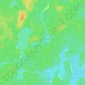
Name: Redstone Lake topographic map, elevation, terrain.
Average elevation: 1,184 ft
Minimum elevation: 1,145 ft
Maximum elevation: 1,243 ft
Make a donation
Gear up for your next adventure:
As an Amazon Associate, this site earns from qualifying purchases at no extra cost to you.
Other topographic maps
Click on a map to view its topography, its elevation and its terrain.
Nepewassi Lake
Canada > Ontario > Sudbury District > Unorganized North Sudbury
Average elevation: 732 ft
Tatachikapika Lake
Canada > Ontario > Sudbury District > Unorganized North Sudbury
Average elevation: 1,263 ft
Cooper Falls
Canada > Ontario > Sudbury District > Unorganized North Sudbury
Average elevation: 1,142 ft
Make a donation
Gear up for your next adventure:
As an Amazon Associate, this site earns from qualifying purchases at no extra cost to you.
Mattagami Lake
Canada > Ontario > Sudbury District > Unorganized North Sudbury > Mattagami
Average elevation: 1,207 ft
Whitefish Falls
Canada > Ontario > Sudbury District > Unorganized North Sudbury
Average elevation: 673 ft
Spanish Chutes
Canada > Ontario > Sudbury District > Unorganized North Sudbury
Average elevation: 1,394 ft
Make a donation
Gear up for your next adventure:
As an Amazon Associate, this site earns from qualifying purchases at no extra cost to you.
Ishpatina Ridge Fire Tower
Canada > Ontario > Sudbury District > Unorganized North Sudbury
Average elevation: 1,788 ft
McLennan Creek;Moodie Lake
Canada > Ontario > Sudbury District > Unorganized North Sudbury
Average elevation: 1,496 ft
Spanish River Provincial Park
Canada > Ontario > Sudbury District > Unorganized North Sudbury
Average elevation: 1,345 ft
Willisville
Canada > Ontario > Sudbury District > Unorganized North Sudbury > Whitefish Falls
Average elevation: 719 ft
Make a donation
Gear up for your next adventure:
As an Amazon Associate, this site earns from qualifying purchases at no extra cost to you.
Wakami Lake
Canada > Ontario > Sudbury District > Unorganized North Sudbury
Average elevation: 1,529 ft
West Shining Tree Lake
Canada > Ontario > Sudbury District > Unorganized North Sudbury > Shining Tree
Average elevation: 1,247 ft
Ministic Lake
Canada > Ontario > Sudbury District > Unorganized North Sudbury
Average elevation: 1,260 ft
Make a donation
Gear up for your next adventure:
As an Amazon Associate, this site earns from qualifying purchases at no extra cost to you.
Shining Tree
Canada > Ontario > Sudbury District > Unorganized North Sudbury
Average elevation: 1,257 ft
Dividing Lake
Canada > Ontario > Sudbury District > Unorganized North Sudbury
Average elevation: 1,283 ft
Onaping Lake
Canada > Ontario > Sudbury District > Unorganized North Sudbury
Average elevation: 1,404 ft
Ridout Lake
Canada > Ontario > Sudbury District > Unorganized North Sudbury
Average elevation: 1,342 ft
Make a donation
Gear up for your next adventure:
As an Amazon Associate, this site earns from qualifying purchases at no extra cost to you.
Halfway Lake Provincial Park
Canada > Ontario > Sudbury District > Unorganized North Sudbury
Average elevation: 1,444 ft
Bennet Lake
Canada > Ontario > Sudbury District > Unorganized North Sudbury
Average elevation: 1,371 ft
Low Water Lake
Canada > Ontario > Sudbury District > Unorganized North Sudbury
Average elevation: 1,401 ft
Birch Island
Canada > Ontario > Sudbury District > Unorganized North Sudbury
Average elevation: 1,234 ft
Make a donation
Gear up for your next adventure:
As an Amazon Associate, this site earns from qualifying purchases at no extra cost to you.