
Cooper topographic map
Click on the map to display elevation.
About this map
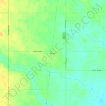
Name: Cooper topographic map, elevation, terrain.
Location: Cooper, Greene County, Iowa, United States (41.90026 -94.36469 41.94026 -94.32469)
Average elevation: 1,066 ft
Minimum elevation: 1,027 ft
Maximum elevation: 1,115 ft
Greene County trails, hiking, mountain biking, running and outdoor activities
Other topographic maps
Click on a map to view its topography, its elevation and its terrain.