
Make a donation
Gear up for your next adventure:
As an Amazon Associate, this site earns from qualifying purchases at no extra cost to you.
Sunnyland topographic map
Click on the map to display elevation.
Make a donation
Gear up for your next adventure:
As an Amazon Associate, this site earns from qualifying purchases at no extra cost to you.
About this map
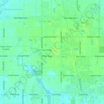
Name: Sunnyland topographic map, elevation, terrain.
Location: Sunnyland, Sarasota County, Florida, 34233, United States (27.26560 -82.51315 27.30560 -82.47315)
Average elevation: 39 ft
Minimum elevation: 20 ft
Maximum elevation: 52 ft
Sarasota County trails, hiking, mountain biking, running and outdoor activities
Make a donation
Gear up for your next adventure:
As an Amazon Associate, this site earns from qualifying purchases at no extra cost to you.
Other topographic maps
Click on a map to view its topography, its elevation and its terrain.
Gulf Gate Estates
United States > Florida > Sarasota County > Gulf Gate Estates
Average elevation: 23 ft
Make a donation
Gear up for your next adventure:
As an Amazon Associate, this site earns from qualifying purchases at no extra cost to you.
South Gate Ridge
United States > Florida > Sarasota County > South Gate Ridge
Average elevation: 39 ft
Make a donation
Gear up for your next adventure:
As an Amazon Associate, this site earns from qualifying purchases at no extra cost to you.
Ridge Wood Heights
United States > Florida > Sarasota County > Ridge Wood Heights
Average elevation: 33 ft
Make a donation
Gear up for your next adventure:
As an Amazon Associate, this site earns from qualifying purchases at no extra cost to you.