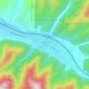
Griffith Peak topographic map
Click on the map to display elevation.
About this map

Name: Griffith Peak topographic map, elevation, terrain.
Location: Griffith Peak, Shoshone County, Idaho, United States (47.91042 -116.27412 47.91052 -116.27402)
Average elevation: 3,688 ft
Minimum elevation: 3,012 ft
Maximum elevation: 4,567 ft
Shoshone County trails, hiking, mountain biking, running and outdoor activities
Other topographic maps
Click on a map to view its topography, its elevation and its terrain.
Wardner
United States > Idaho > Shoshone County
Wardner is located at 47°31′23″N 116°8′3″W / 47.52306°N 116.13417°W / 47.52306; -116.13417 (47.523164, -116.134190), at an elevation of 2,657 feet (810 m) above sea level.
Average elevation: 3,891 ft
Kellogg
United States > Idaho > Shoshone County
Kellogg is located at 47°32′18″N 116°07′31″W / 47.53833°N 116.12528°W / 47.53833; -116.12528 (47.538391, -116.125406), at an elevation of 2,303 feet (702 m) above sea level.
Average elevation: 3,081 ft
Mullan
United States > Idaho > Shoshone County
In Shoshone County at the east end of the Silver Valley, Mullan is in a sheltered canyon of the Coeur d'Alene Mountains at an elevation of 3,278 feet (1,000 m) above sea level. The entrance to the Lucky Friday mine is several hundred yards east of the city center; the active mine (silver, lead, & zinc)…
Average elevation: 3,832 ft
Mullan
United States > Idaho > Shoshone County
In Shoshone County at the east end of the Silver Valley, Mullan is in a sheltered canyon of the Coeur d'Alene Mountains at an elevation of 3,278 feet (1,000 m) above sea level. The entrance to the Lucky Friday mine is several hundred yards east of the city center; the active mine (silver, lead, & zinc)…
Average elevation: 3,832 ft
Kellogg
United States > Idaho > Shoshone County
Kellogg is located at 47°32′18″N 116°07′31″W / 47.53833°N 116.12528°W / 47.53833; -116.12528 (47.538391, -116.125406), at an elevation of 2,303 feet (702 m) above sea level.
Average elevation: 3,081 ft
Mullan
United States > Idaho > Shoshone County
In Shoshone County at the east end of the Silver Valley, Mullan is in a sheltered canyon of the Coeur d'Alene Mountains at an elevation of 3,278 feet (1,000 m) above sea level. The entrance to the Lucky Friday mine is several hundred yards east of the city center; the active mine (silver, lead, & zinc)…
Average elevation: 3,832 ft