Geolocate

Jakes Corner topographic map

Click on the map to display elevation.

About this map

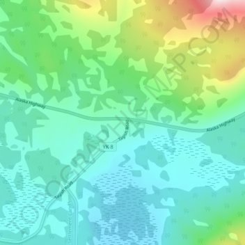
Name: Jakes Corner topographic map, elevation, terrain.

Location: Jakes Corner, Yukon, Canada (60.31909 -134.00642 60.35909 -133.96642)

Average elevation: 2,703 ft

Minimum elevation: 2,303 ft

Maximum elevation: 4,114 ft

Other topographic maps

Click on a map to view its topography, its elevation and its terrain.

Porter Creek

Canada > Yukon > Whitehorse

Average elevation: 2,329 ft

Haines Junction

Canada > Yukon

Average elevation: 2,060 ft

Carmacks

Canada > Yukon

Average elevation: 2,034 ft

Teslin Post 13

Canada > Yukon

Average elevation: 2,280 ft

Bear Creek

Canada > Yukon

Average elevation: 2,116 ft

Burwash Landing

Canada > Yukon > Burwash Landing

Average elevation: 2,717 ft

Destruction Bay

Canada > Yukon > Destruction Bay

Average elevation: 2,930 ft

Bear Creek

Canada > Yukon > Bear Creek

Average elevation: 2,119 ft

Victoria Lake

Canada > Yukon

Average elevation: 3,192 ft

Teslin

Canada > Yukon > Teslin

Average elevation: 2,300 ft

Beaver Creek

Canada > Yukon > Beaver Creek

Average elevation: 2,195 ft

Sambo Creek

Canada > Yukon

Average elevation: 2,218 ft

Gear up for your next adventure:

👟Men's Trail Runners - Lightweight footwear for fast-paced exploration and light hiking
🪶Camping Sleeping Pad - Comfortable sleeping pad for backpacking
📖Nature Tracking Books - Learn to track wildlife and terrain
👓Polarized Sunglasses - Outdoor sunglasses for glare reduction
🧣Merino Neck Gaiters - Multi-functional headwear for wind and sun protection

As an Amazon Associate, this site earns from qualifying purchases at no extra cost to you.