Geolocate

Gamaliel topographic map

Click on the map to display elevation.

About this map

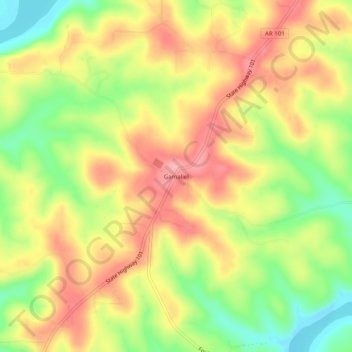
Name: Gamaliel topographic map, elevation, terrain.

Location: Gamaliel, Baxter County, Arkansas, 72537, United States (36.43673 -92.25321 36.47673 -92.21321)

Average elevation: 751 ft

Minimum elevation: 538 ft

Maximum elevation: 932 ft

Baxter County trails, hiking, mountain biking, running and outdoor activities

Other topographic maps

Click on a map to view its topography, its elevation and its terrain.

Cotter

United States > Arkansas > Baxter County

Average elevation: 558 ft

White River

United States > Arkansas > Baxter County

Average elevation: 486 ft

Mountain Home

United States > Arkansas > Baxter County

Average elevation: 833 ft

Norfork

United States > Arkansas > Baxter County

Average elevation: 600 ft

Lakeview

United States > Arkansas > Baxter County

Average elevation: 728 ft

Norfork

United States > Arkansas > Baxter County

Average elevation: 600 ft

Lakeview

United States > Arkansas > Baxter County

Average elevation: 728 ft

Big Flat

United States > Arkansas > Baxter County

Average elevation: 1,161 ft

Mountain Home

United States > Arkansas > Baxter County

Average elevation: 833 ft

Lakeview

United States > Arkansas > Baxter County

Average elevation: 728 ft

Cotter

United States > Arkansas > Baxter County > Cotter

Average elevation: 558 ft

Gear up for your next adventure:

📷Action Camera - Capture your outdoor adventures in HD
🚗GPS Dash Cams - Record your scenic drives through mountain passes and canyons
📡Handheld GPS Device - Reliable handheld GPS for outdoor navigation
🧣Hiking Neck Gaiter - Multi‑use neck protection for outdoor weather
📚Navigation Handbooks - Master the art of reading topographic maps and using a compass

As an Amazon Associate, this site earns from qualifying purchases at no extra cost to you.