
Bald Rock Heritage Preserve topographic map
Interactive map
Click on the map to display elevation.
About this map
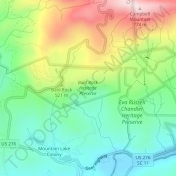
Name: Bald Rock Heritage Preserve topographic map, elevation, terrain.
Average elevation: 1,575 ft
Minimum elevation: 1,033 ft
Maximum elevation: 2,523 ft
Other topographic maps
Click on a map to view its topography, its elevation and its terrain.
Greenville
United States > South Carolina > Greenville County
Greenville, Greenville County, South Carolina, United States
Average elevation: 951 ft
Travelers Rest
United States > South Carolina > Greenville County
Travelers Rest, Greenville County, South Carolina, 29613, United States
Average elevation: 1,109 ft
Greer
United States > South Carolina > Greenville County
Greer, Greenville County, South Carolina, United States
Average elevation: 915 ft
East Gantt
United States > South Carolina > Greenville County
East Gantt, Greenville County, South Carolina, 29636, United States
Average elevation: 922 ft
Conestee
United States > South Carolina > Greenville County
Conestee, Greenville County, South Carolina, 29636, United States
Average elevation: 860 ft
Sans Souci
United States > South Carolina > Greenville County
Sans Souci, Greenville County, South Carolina, United States
Average elevation: 1,017 ft
Judson
United States > South Carolina > Greenville County > Judson
Judson, Greenville County, South Carolina, United States
Average elevation: 984 ft
Golden Grove
United States > South Carolina > Greenville County
Golden Grove, Greenville County, South Carolina, 29673, United States
Average elevation: 843 ft
Georgia Street Park
United States > South Carolina > Greenville County > Fountain Inn
Georgia Street Park, Fountain Inn, Greenville County, South Carolina, United States
Average elevation: 843 ft
West Greenville
United States > South Carolina > Greenville County
West Greenville, Greenville County, South Carolina, 29611, United States
Average elevation: 984 ft
Simpsonville
United States > South Carolina > Greenville County
Simpsonville, Greenville County, South Carolina, United States
Average elevation: 846 ft
Parker
United States > South Carolina > Greenville County > Poinsett
Parker, Poinsett, Greenville County, South Carolina, 29611, United States
Average elevation: 988 ft
Berea
United States > South Carolina > Greenville County > Berea Heights
Berea, Berea Heights, Greenville County, South Carolina, 29617, United States
Average elevation: 978 ft
Northwood Hills
United States > South Carolina > Greenville County
Northwood Hills, Greenville County, South Carolina, 29617, United States
Average elevation: 1,014 ft
Duncan Township
United States > South Carolina > Greenville County
Duncan Township, Greenville County, South Carolina, United States
Average elevation: 669 ft
Lake Lanier
United States > South Carolina > Greenville County > Lake Lanier
Lake Lanier, Greenville County, South Carolina, 29256, United States
Average elevation: 1,152 ft
Gantt
United States > South Carolina > Greenville County
Gantt, Greenville County, South Carolina, United States
Average elevation: 915 ft
Montague
United States > South Carolina > Greenville County
Montague, Greenville County, South Carolina, 29613, United States
Average elevation: 1,020 ft
Oak Meadows
United States > South Carolina > Greenville County
Oak Meadows, Greenville County, South Carolina, 29681, United States
Average elevation: 889 ft
Saluda Lake
United States > South Carolina > Greenville County
Saluda Lake, Greenville County, South Carolina, United States
Average elevation: 955 ft
Kendall Green
United States > South Carolina > Greenville County > Greenville
Kendall Green, Greenville, Greenville County, South Carolina, 29614, United States
Average elevation: 978 ft
Tigerville
United States > South Carolina > Greenville County
Tigerville, Greenville County, South Carolina, 29688, United States
Average elevation: 994 ft
Gowensville
United States > South Carolina > Greenville County
Gowensville, Greenville County, South Carolina, 29356, United States
Average elevation: 1,017 ft
Paris Mountain State Park
United States > South Carolina > Greenville County
Paris Mountain State Park, Greenville County, South Carolina, United States
Average elevation: 1,237 ft
Parkstone
United States > South Carolina > Greenville County
Parkstone, Greenville County, South Carolina, 29609, United States
Average elevation: 1,138 ft
Marshall Forest
United States > South Carolina > Greenville County > Greenville
Marshall Forest, Greenville, Greenville County, South Carolina, 29605, United States
Average elevation: 912 ft
Possum Kingdom
United States > South Carolina > Greenville County
Possum Kingdom, Greenville County, South Carolina, United States
Average elevation: 705 ft
Enchanted Forest
United States > South Carolina > Greenville County
Enchanted Forest, Greenville County, South Carolina, 29617, United States
Average elevation: 997 ft
Thornwood Acres
United States > South Carolina > Greenville County
Thornwood Acres, Greenville County, South Carolina, 29615, United States
Average elevation: 932 ft
Alta Vista
United States > South Carolina > Greenville County > Greenville
Alta Vista, Greenville, Greenville County, South Carolina, 29601, United States
Average elevation: 938 ft
Taylors
United States > South Carolina > Greenville County
Taylors, Greenville County, South Carolina, 29698, United States
Average elevation: 935 ft
Bald Rock
United States > South Carolina > Greenville County
Bald Rock, Greenville County, South Carolina, 29635, United States
Average elevation: 1,565 ft
Royal Oaks
United States > South Carolina > Greenville County
Royal Oaks, Greenville County, South Carolina, 29636, United States
Average elevation: 912 ft
Marietta
United States > South Carolina > Greenville County
Marietta, Greenville County, South Carolina, 29683, United States
Average elevation: 1,040 ft
McKelvey Crossroads
United States > South Carolina > Greenville County
McKelvey Crossroads, Greenville County, South Carolina, United States
Average elevation: 823 ft
Jones Gap State Park
United States > South Carolina > Greenville County
Jones Gap State Park, Greenville County, South Carolina, United States
Average elevation: 2,175 ft
The Vintage Apartment Homes
United States > South Carolina > Greenville County > Greenville
The Vintage Apartment Homes, Greenville, Greenville County, South Carolina, 29614, United States
Average elevation: 1,001 ft
Mauldin
United States > South Carolina > Greenville County
Mauldin, Greenville County, South Carolina, 29662, United States
Average elevation: 896 ft
Chestnut Ridge Heritage Preserve
United States > South Carolina > Greenville County
Chestnut Ridge Heritage Preserve, Greenville County, South Carolina, United States
Average elevation: 1,283 ft
Fountain Inn
United States > South Carolina > Greenville County
Fountain Inn, Greenville County, South Carolina, 29644, United States
Average elevation: 817 ft
Wildaire
United States > South Carolina > Greenville County
Wildaire, Greenville County, South Carolina, 29614, United States
Average elevation: 991 ft
Mountain View Homes
United States > South Carolina > Greenville County > Greenville
Mountain View Homes, Greenville, Greenville County, South Carolina, 29602, United States
Average elevation: 981 ft
Greer
United States > South Carolina > Greenville County > Greer > Greer
Greer, Greenville County, South Carolina, 29651, United States
Average elevation: 925 ft
Cunningham Acres
United States > South Carolina > Greenville County
Cunningham Acres, Greenville County, South Carolina, 29615, United States
Average elevation: 938 ft
Belle Meade
United States > South Carolina > Greenville County
Belle Meade, Greenville County, South Carolina, 29605, United States
Average elevation: 912 ft
Valley Haven
United States > South Carolina > Greenville County > Valley Haven
Valley Haven, Greenville County, South Carolina, 29652, United States
Average elevation: 932 ft
Boyce Lawn
United States > South Carolina > Greenville County > Greenville
Boyce Lawn, Greenville, Greenville County, South Carolina, 29601, United States
Average elevation: 951 ft
Caesars Head Mountain
United States > South Carolina > Greenville County
Caesars Head Mountain, Greenville County, South Carolina, 29635, United States
Average elevation: 2,480 ft
Cleveland
United States > South Carolina > Greenville County
Cleveland, Greenville County, South Carolina, 29661, United States
Average elevation: 1,138 ft
Landrum Watershed
United States > South Carolina > Greenville County
Landrum Watershed, Greenville County, South Carolina, United States
Average elevation: 2,106 ft