
Pergau Dam topographic map
Click on the map to display elevation.
About this map
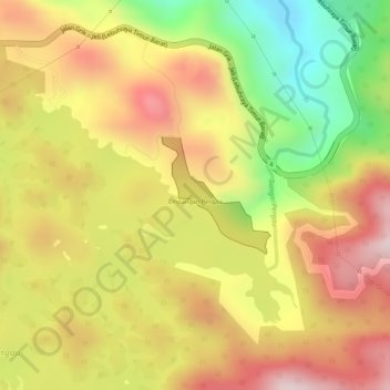
Name: Pergau Dam topographic map, elevation, terrain.
Location: Pergau Dam, Jeli, Kelantan, Malaysia (5.62119 101.69818 5.62931 101.70570)
Average elevation: 2,080 ft
Minimum elevation: 1,325 ft
Maximum elevation: 2,631 ft
Other topographic maps
Click on a map to view its topography, its elevation and its terrain.
Pulau Renjuna
Malaysia > Kelantan > Kampung Pulau Beluru > Kampung Pulau Seratus
Average elevation: 13 ft
Gunung Stong
The mountain features hill dipterocarp, upper dipterocarp and montane forests, as the elevation gradually increases. There is an abundance of flora containing beneficial and medicinal properties that can be obtained within these forests.
Average elevation: 3,625 ft
Kuala Krai
Kuala Krai (alternative spelling: Kuala Kerai, Jawi: كوالا كراي) is a town located in the coterminous Kuala Krai District in southern-central Kelantan, Malaysia. During British protection it was known as Kuala Lebir. It is 67 km from state capital Kota Bharu and 273 km from national capital Kuala…
Average elevation: 817 ft
Kelantan River
The river's tributaries rise in the forested mountains in the Gua Musang region in southern Kelantan, where many Orang Asli tribes live. The area is known for its karst topography, dotted with mogotes with numerous caves beneath them. Some cave systems along the Nenggiri River, the river's left tributary, show…
Average elevation: 233 ft
Mount Chamah
Gunung Chamah lies in the north-western corner of Kelantan and is the fifth highest mountain in Peninsular Malaysia. It is one of the Peninsula's G7 (mountains above 7,000 ft/2,134m). Gunung in Malay literally means mountains with an elevation of 1,000 m and above. In Peninsular Malaysia, there are several of…
Average elevation: 5,938 ft
Kelantan River
The river's tributaries rise in the forested mountains in the Gua Musang region in southern Kelantan, where many Orang Asli tribes live. The area is known for its karst topography, dotted with mogotes with numerous caves beneath them. Some cave systems along the Nenggiri River, the river's left tributary, show…
Average elevation: 233 ft