
虎溪街道 topographic map
Interactive map
Click on the map to display elevation.
About this map
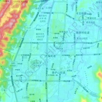
Name: 虎溪街道 topographic map, elevation, terrain.
Location: 虎溪街道, 重庆高新区, 沙坪坝区, 重庆市, 401331, 中国 (29.58229 106.25752 29.64081 106.33341)
Average elevation: 1,168 ft
Minimum elevation: 896 ft
Maximum elevation: 2,129 ft
Other topographic maps
Click on a map to view its topography, its elevation and its terrain.