
Bulverde topographic map
Click on the map to display elevation.
About this map
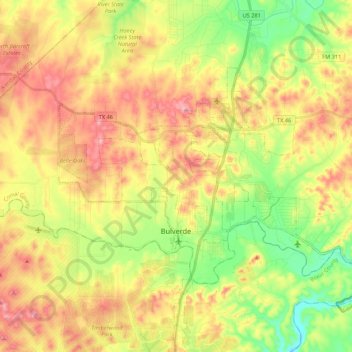
Name: Bulverde topographic map, elevation, terrain.
Location: Bulverde, Comal County, Texas, United States (29.71563 -98.52530 29.83061 -98.31001)
Average elevation: 1,194 ft
Minimum elevation: 876 ft
Maximum elevation: 1,535 ft
Comal County trails, hiking, mountain biking, running and outdoor activities
Other topographic maps
Click on a map to view its topography, its elevation and its terrain.