
弥城镇 topographic map
Interactive map
Click on the map to display elevation.
About this map
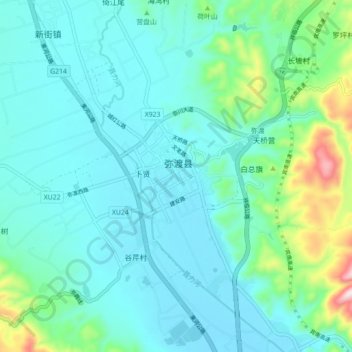
Name: 弥城镇 topographic map, elevation, terrain.
Location: 弥城镇, 弥渡县, 大理白族自治州, 云南省, 中国 (25.30389 100.44925 25.38389 100.52925)
Average elevation: 5,692 ft
Minimum elevation: 5,443 ft
Maximum elevation: 6,867 ft
Other topographic maps
Click on a map to view its topography, its elevation and its terrain.