
长坡村 topographic map
Interactive map
Click on the map to display elevation.
About this map
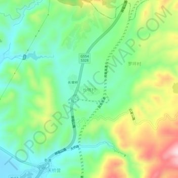
Name: 长坡村 topographic map, elevation, terrain.
Location: 长坡村, 弥渡县, 大理白族自治州, 云南省, 中国 (25.35027 100.50005 25.39027 100.54005)
Average elevation: 5,971 ft
Minimum elevation: 5,528 ft
Maximum elevation: 6,801 ft
Other topographic maps
Click on a map to view its topography, its elevation and its terrain.