
景谷 topographic map
Interactive map
Click on the map to display elevation.
About this map
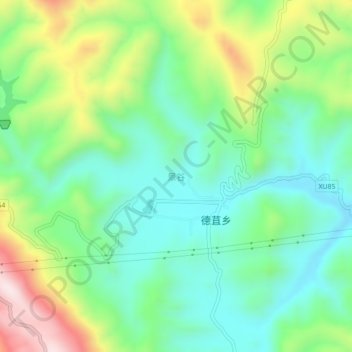
Name: 景谷 topographic map, elevation, terrain.
Location: 景谷, 弥渡县, 大理白族自治州, 云南省, 中国 (25.10410 100.62900 25.14410 100.66900)
Average elevation: 5,210 ft
Minimum elevation: 4,665 ft
Maximum elevation: 6,345 ft
Other topographic maps
Click on a map to view its topography, its elevation and its terrain.