
弥渡县 topographic map
Interactive map
Click on the map to display elevation.
About this map
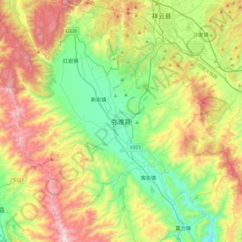
Name: 弥渡县 topographic map, elevation, terrain.
Location: 弥渡县, 大理白族自治州, 云南省, 中国 (25.18694 100.32978 25.50694 100.64978)
Average elevation: 6,864 ft
Minimum elevation: 5,052 ft
Maximum elevation: 9,872 ft
Other topographic maps
Click on a map to view its topography, its elevation and its terrain.