Geolocate

龙西乡 topographic map

Interactive map

Click on the map to display elevation.

About this map

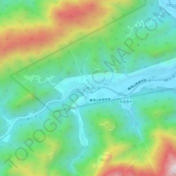
Name: 龙西乡 topographic map, elevation, terrain.

Location: 龙西乡, 温州市, 浙江省, 325616, 中国 (28.37563 121.02259 28.41563 121.06259)

Average elevation: 1,033 ft

Minimum elevation: 151 ft

Maximum elevation: 2,995 ft

Other topographic maps

Click on a map to view its topography, its elevation and its terrain.

智仁乡

中国 > 浙江省 > 温州市

智仁乡, 温州市, 浙江省, 中国

Average elevation: 600 ft

樟岙村

中国 > 浙江省 > 温州市

樟岙村, 温州市, 浙江省, 中国

Average elevation: 781 ft

岙里村

中国 > 浙江省 > 温州市

岙里村, 温州市, 浙江省, 中国

Average elevation: 105 ft

马鞍

中国 > 浙江省 > 温州市

马鞍, 温州市, 浙江省, 中国

Average elevation: 1,027 ft

环山村

中国 > 浙江省 > 温州市

环山村, 温州市, 浙江省, 中国

Average elevation: 486 ft

溪下乡

中国 > 浙江省 > 温州市

溪下乡, 温州市, 浙江省, 中国

Average elevation: 2,346 ft

双峰乡

中国 > 浙江省 > 温州市

双峰乡, 温州市, 浙江省, 中国

Average elevation: 338 ft

福建省星仔列岛省级海洋特别保护区

中国 > 浙江省 > 温州市

福建省星仔列岛省级海洋特别保护区, 温州市, 浙江省, 中国

Average elevation: 0 ft

甲鼎山

中国 > 浙江省 > 温州市

甲鼎山, 温州市, 浙江省, 中国

Average elevation: 1,926 ft

白马尖

中国 > 浙江省 > 温州市

白马尖, 温州市, 浙江省, 中国

Average elevation: 2,415 ft

太石山

中国 > 浙江省 > 温州市

太石山, 温州市, 浙江省, 中国

Average elevation: 1,214 ft

灵昆岛

中国 > 浙江省 > 温州市

灵昆岛, 温州市区, 洞头区, 温州市, 浙江省, 中国

Average elevation: 233 ft