Geolocate

Kinta topographic map

Click on the map to display elevation.

About this map

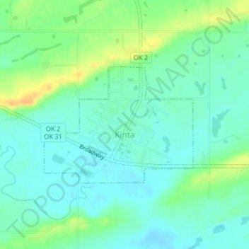
Name: Kinta topographic map, elevation, terrain.

Location: Kinta, Haskell County, Oklahoma, 74552, United States (35.11401 -95.24844 35.12665 -95.22865)

Average elevation: 564 ft

Minimum elevation: 528 ft

Maximum elevation: 636 ft

Haskell County trails, hiking, mountain biking, running and outdoor activities

Other topographic maps

Click on a map to view its topography, its elevation and its terrain.

Hoyt

United States > Oklahoma > Haskell County

Average elevation: 558 ft

Enterprise

United States > Oklahoma > Haskell County

Average elevation: 702 ft

Lequire

United States > Oklahoma > Haskell County

Average elevation: 607 ft

Brooken Mountain

United States > Oklahoma > Haskell County

Average elevation: 820 ft

Gear up for your next adventure:

❄️Traction Cleats - Prevent slips on icy trails during winter hikes
🖼️Topo Map Wall Art - Decorative topographic prints of famous peaks and regions
🌡️Handheld Weather Meters - Measure wind, temp, and pressure for safe mountain travel
🧥Waterproof Jacket for Hiking - Breathable and rugged rain jacket for outdoor excursions
🩳Quick‑Dry Hiking Shorts - Comfortable and quick‑dry shorts for summer hiking

As an Amazon Associate, this site earns from qualifying purchases at no extra cost to you.