Geolocate

Hoyt topographic map

Click on the map to display elevation.

About this map

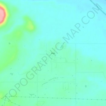
Name: Hoyt topographic map, elevation, terrain.

Location: Hoyt, Haskell County, Oklahoma, United States (35.25176 -95.32219 35.29176 -95.28219)

Average elevation: 558 ft

Minimum elevation: 486 ft

Maximum elevation: 892 ft

Haskell County trails, hiking, mountain biking, running and outdoor activities

Other topographic maps

Click on a map to view its topography, its elevation and its terrain.

Tamaha

United States > Oklahoma > Haskell County

Average elevation: 482 ft

Whitefield

United States > Oklahoma > Haskell County

Average elevation: 531 ft

McCurtain

United States > Oklahoma > Haskell County

Average elevation: 587 ft

Keota

United States > Oklahoma > Haskell County

Average elevation: 489 ft

Kinta

United States > Oklahoma > Haskell County

Average elevation: 564 ft

Stigler

United States > Oklahoma > Haskell County

Average elevation: 577 ft

Gear up for your next adventure:

🧭Compass with Lanyard - Easy‑carry compass for navigation
🪶Thermal Camp Blanket - Extra warmth for cold nights
🌎3D Topographic Globes - Raised relief globes for a tactile understanding of geography
🔭Telescopic Hiking Pole - Adjustable pole for hiking stability
💧Water Purification System - Clean water on the trail with reliable purifiers

As an Amazon Associate, this site earns from qualifying purchases at no extra cost to you.