Geolocate

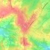
Royal Tunbridge Wells topographic map

Click on the map to display elevation.

About this map
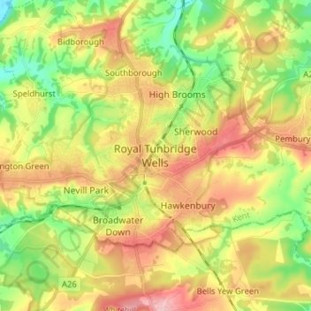
Name: Royal Tunbridge Wells topographic map, elevation, terrain.

Location: Royal Tunbridge Wells, Tunbridge Wells, Kent, England, TN1 2DL, United Kingdom (51.09715 0.22734 51.17715 0.30734)

Average elevation: 325 ft

Minimum elevation: 89 ft

Maximum elevation: 594 ft

Other topographic maps

Click on a map to view its topography, its elevation and its terrain.
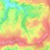
Frittenden

United Kingdom > England > Kent > Tunbridge Wells

Average elevation: 112 ft

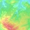
Hawkhurst

United Kingdom > England > Kent > Tunbridge Wells

Average elevation: 220 ft

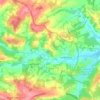
Paddock Wood

United Kingdom > England > Kent > Tunbridge Wells

Average elevation: 108 ft

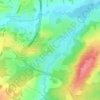
Goudhurst

United Kingdom > England > Kent > Tunbridge Wells > Goudhurst

Average elevation: 249 ft

Benenden

United Kingdom > England > Kent > Tunbridge Wells

Average elevation: 200 ft

Pembury

United Kingdom > England > Kent > Tunbridge Wells

Average elevation: 325 ft

Bidborough

United Kingdom > England > Kent > Tunbridge Wells

Average elevation: 233 ft

Horsmonden

United Kingdom > England > Kent > Tunbridge Wells > Horsmonden

Average elevation: 167 ft

Speldhurst

United Kingdom > England > Kent > Tunbridge Wells

Average elevation: 292 ft

Rusthall

United Kingdom > England > Kent > Tunbridge Wells > Rusthall

Average elevation: 328 ft

Capel

United Kingdom > England > Kent > Tunbridge Wells

Average elevation: 154 ft

Hurst Wood

United Kingdom > England > Kent > Tunbridge Wells > Rusthall

Average elevation: 331 ft

Lamberhurst

United Kingdom > England > Kent > Tunbridge Wells > Lamberhurst

Average elevation: 276 ft

Speldhurst

United Kingdom > England > Kent > Tunbridge Wells

Average elevation: 292 ft

Benenden

United Kingdom > England > Kent > Tunbridge Wells > Benenden

Average elevation: 200 ft

Hawkhurst

United Kingdom > England > Kent > Tunbridge Wells

Average elevation: 220 ft

Benenden

United Kingdom > England > Kent > Tunbridge Wells

Average elevation: 200 ft

Goudhurst

United Kingdom > England > Kent > Tunbridge Wells

Average elevation: 249 ft

Paddock Wood

United Kingdom > England > Kent > Tunbridge Wells > Whetsted

Average elevation: 108 ft

Capel

United Kingdom > England > Kent > Tunbridge Wells

Average elevation: 154 ft

Gear up for your next adventure:

🔦Compact Flashlight - Reliable flashlight for emergencies
⛺Backpacking Tent - Lightweight and durable tent for multi‑day hikes
⛑️Personal Locator Beacon - Safety beacon for emergencies
🎒Outdoor Daypacks - Lightweight backpacks designed for carrying maps and essential gear
👖Convertible Hiking Pants - Versatile zip-off pants for changing altitudes and temperatures

As an Amazon Associate, this site earns from qualifying purchases at no extra cost to you.