Geolocate

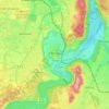
Tauting topographic map

Click on the map to display elevation.

About this map

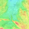
Name: Tauting topographic map, elevation, terrain.

Location: Tauting, Eglfing, Huglfing (VGem), Landkreis Weilheim-Schongau, Bavaria, Germany (47.74166 11.17602 47.74738 11.18369)

Average elevation: 2,133 ft

Minimum elevation: 1,998 ft

Maximum elevation: 2,247 ft

Other topographic maps

Click on a map to view its topography, its elevation and its terrain.
Polling

Germany > Bavaria > Landkreis Weilheim-Schongau

Average elevation: 1,949 ft

Huglfing

Germany > Bavaria > Landkreis Weilheim-Schongau

Average elevation: 2,100 ft

Steingaden

Germany > Bavaria > Landkreis Weilheim-Schongau

Average elevation: 2,618 ft

Penzberg

Germany > Bavaria > Landkreis Weilheim-Schongau

Average elevation: 1,988 ft

Schongau

Germany > Bavaria > Landkreis Weilheim-Schongau

Average elevation: 2,365 ft

Erbenschwang

Germany > Bavaria > Landkreis Weilheim-Schongau

Average elevation: 2,552 ft

Dessau

Germany > Bavaria > Landkreis Weilheim-Schongau > Burggen

Average elevation: 2,457 ft

Raisting

Germany > Bavaria > Landkreis Weilheim-Schongau

Average elevation: 1,847 ft

Fischen

Germany > Bavaria > Landkreis Weilheim-Schongau

Average elevation: 1,893 ft

Schongau

Germany > Bavaria > Landkreis Weilheim-Schongau

Average elevation: 2,365 ft

Hohenpeißenberg

Germany > Bavaria > Landkreis Weilheim-Schongau

The climate is oceanic (Köppen: Cfb), affected by altitude and proximity to the Alps (especially in precipitation). Registering data continuously since 1781, the Hohenpeißenberg Observatory is the oldest in the world located on a mountain. The station located in the alpine foothills integrates the German…

Average elevation: 2,402 ft

Gear up for your next adventure:

🧷Carabiner Set - Durable clips for gear attachment
🔭Compact Binoculars - HD vision for scouting terrain and identifying distant landmarks
🪓Survival Multi‑Tool - Versatile tool for camp and trail tasks
🧦Hiking Socks - Comfortable socks to prevent blisters on long hikes
🧭Compass with Lanyard - Easy‑carry compass for navigation

As an Amazon Associate, this site earns from qualifying purchases at no extra cost to you.