Geolocate

Pike Bay topographic map

Click on the map to display elevation.

About this map

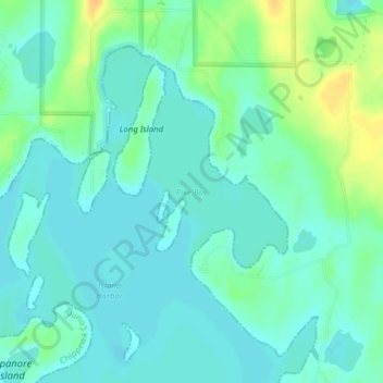
Name: Pike Bay topographic map, elevation, terrain.

Location: Pike Bay, Michigan, United States (45.95414 -83.81255 45.95424 -83.81245)

Average elevation: 591 ft

Minimum elevation: 561 ft

Maximum elevation: 656 ft

Other topographic maps

Click on a map to view its topography, its elevation and its terrain.

Lenawee County

United States > Michigan

Average elevation: 827 ft

Gaylord

United States > Michigan > Otsego County > Gaylord

Gaylord became a city in 1922. The change from village to city required a vote by town residents. For reasons that are unclear, the margin of passage was a very close 21 votes — 114 people in favor to 93 against. John Hamilton was elected the first mayor of Gaylord. Over the years, the community continued to…

Average elevation: 1,316 ft

Clare County

United States > Michigan

Average elevation: 1,053 ft

Lake Orion

United States > Michigan > Oakland County

Average elevation: 994 ft

Dearborn

United States > Michigan > Wayne County

Average elevation: 604 ft

Mackinaw City

United States > Michigan > Cheboygan County

Average elevation: 604 ft

Port Huron

United States > Michigan > Saint Clair County

Average elevation: 607 ft

St. Clair River

United States > Michigan > SaintClair

The river is 40.5 miles (65.2 km) long and drops 5 feet (2 m) in elevation from Lake Huron to Lake St. Clair. The flow rate averages around 182,000 cubic feet per second (5,200 m3/s), and the drainage area is 223,600 square miles (579,000 km2). This takes into account the combined drainage areas of Lakes…

Average elevation: 627 ft

Allendale

United States > Michigan > Ottawa County > Allendale

Average elevation: 640 ft

Cadillac

United States > Michigan > Wexford County

Average elevation: 1,329 ft

Brooks Township

United States > Michigan > Newaygo County

Average elevation: 778 ft

Midland County

United States > Michigan

Average elevation: 669 ft

Harrison Township

United States > Michigan > Macomb County

Average elevation: 581 ft

Bright Lake

United States > Michigan > Leelanau County

Average elevation: 912 ft

Lakes of the North

United States > Michigan > Antrim County

Average elevation: 1,293 ft

Hatchet Lake

United States > Michigan > Keweenaw County

Average elevation: 876 ft

Markey Township

United States > Michigan > Roscommon County

Average elevation: 1,152 ft

Clarkston

United States > Michigan > Oakland County

Average elevation: 1,010 ft

St. Marys River

United States > Michigan

Average elevation: 659 ft

Maynard Lake

United States > Michigan > Calhoun County

Average elevation: 945 ft

Sage Township

United States > Michigan > Gladwin County

Average elevation: 866 ft

Auger Lake

United States > Michigan > Luce County

Average elevation: 879 ft

Lake Saint Clair

United States > Michigan > Macomb County

Average elevation: 581 ft

Leelanau County

United States > Michigan

Average elevation: 607 ft

Bridgman

United States > Michigan > Berrien County

Average elevation: 653 ft

Richmond Lake

United States > Michigan > Newaygo County

Average elevation: 958 ft

Bloomfield Hills

United States > Michigan > Oakland County

Average elevation: 856 ft

Houghton

United States > Michigan > Houghton County

Average elevation: 883 ft

Baltimore Township

United States > Michigan > Barry County

Average elevation: 919 ft

Independence Charter Township

United States > Michigan > Oakland County

Independence Township is located along the Hillsdale-Lapeer Moraine Range. The highest hill along that range in Independence Township is Pine Knob, at 1,221 feet. It is also the highest point in Southeastern Michigan. Only three miles away is Waterford Hill, the second highest hill in Independence Township…

Average elevation: 1,043 ft

Grand Rapids

United States > Michigan > Kent County

Grand Rapids developed on the banks of the Grand River, where there was once a set of rapids, at an altitude of 610 feet (186 m) above sea level. Ships could navigate on the river up to this fall line, stopping because of the rapids. The river valley is flat and narrow, surrounded by steep hills and bluffs.…

Average elevation: 709 ft

Liberty Township

United States > Michigan > Wexford County

Average elevation: 1,027 ft

Chester Township

United States > Michigan > Ottawa County

Average elevation: 764 ft

Moore Lake

United States > Michigan > Newaygo County

Average elevation: 820 ft

Franklin

United States > Michigan > Oakland County

Average elevation: 791 ft

Onsted

United States > Michigan > Lenawee County

Average elevation: 988 ft

Big Creek Township

United States > Michigan > Oscoda County

Average elevation: 1,148 ft

Moscow Township

United States > Michigan > Hillsdale County

Average elevation: 1,142 ft

Ojibway Island

United States > Michigan > Saginaw County > Saginaw

Average elevation: 607 ft

Sturgeon River

United States > Michigan > Dickinson County

Average elevation: 1,004 ft

Elmwood Township

United States > Michigan > Tuscola County

Average elevation: 712 ft

Haynes Township

United States > Michigan > Alcona County

Average elevation: 761 ft

Walled Lake

United States > Michigan > Oakland County

Average elevation: 942 ft

Mattawan

United States > Michigan > Van Buren County

Average elevation: 863 ft

Carp Lake Township

United States > Michigan > Emmet County

Average elevation: 741 ft

Shelby Township

United States > Michigan > Oceana County

Average elevation: 856 ft

Utica

United States > Michigan > Macomb County

Average elevation: 646 ft

Two Lakes

United States > Michigan > Alger County

Average elevation: 719 ft

Jackson County

United States > Michigan

Average elevation: 988 ft

Turtle Valley

United States > Michigan > Muskegon County

Average elevation: 673 ft

Chase Lake

United States > Michigan > Kent County > Ada Township

Average elevation: 840 ft

Saranac

United States > Michigan > Ionia County

Average elevation: 689 ft

Rochester

United States > Michigan > Oakland County

Average elevation: 794 ft

Greens Lake

United States > Michigan > Oakland County

Average elevation: 1,014 ft

Deep Lake

United States > Michigan > Barry County

Average elevation: 883 ft

Bear Lake Township

United States > Michigan > Kalkaska County

Average elevation: 1,181 ft

Clinton Township

United States > Michigan > Macomb County

Average elevation: 604 ft

Lake Macatawa

United States > Michigan > Ottawa County > Beechwood

Average elevation: 607 ft

Wolverine Lake

United States > Michigan > Wolverine Lake

Average elevation: 935 ft

Belle Isle

United States > Michigan > Wayne County > Detroit

Average elevation: 581 ft

Wexford Township

United States > Michigan > Wexford County

Average elevation: 1,037 ft

Frankfort

United States > Michigan > Frankfort

Frankfort is a city in Benzie County in the U.S. state of Michigan. The population was 1,286 at the 2010 census. The elevation of Frankfort is 600 ft (183 m) above sea level. The city is situated with Lake Michigan to the west, Lake Betsie, formed by the Betsie River before flowing into Lake Michigan, on the…

Average elevation: 636 ft

Big Fish Lake

United States > Michigan > Lapeer County > Kerr Hill

Average elevation: 1,076 ft

Howell

United States > Michigan > Livingston County

Average elevation: 925 ft

Franklin Township

United States > Michigan > Clare County

Average elevation: 1,135 ft

New Buffalo

United States > Michigan > Berrien County > New Buffalo

Average elevation: 627 ft

Wayne Township

United States > Michigan > Cass County

Average elevation: 823 ft

Myers Lake

United States > Michigan > Genesee County

Average elevation: 860 ft

Brighton

United States > Michigan > Livingston County

Average elevation: 942 ft

Perch Lake

United States > Michigan > Lake

Average elevation: 1,079 ft

Escanaba

United States > Michigan > Escanaba

Average elevation: 597 ft

Tecumseh Park

United States > Michigan > Tecumseh

Average elevation: 817 ft

Wayne County

United States > Michigan

Grosse Ile is the largest island in the county and is connected to the mainland by the Wayne County Bridge and the Grosse Ile Toll Bridge. The highest elevation (990 feet (300 m)) in the county is near Northville, in Maybury State Park.

Average elevation: 666 ft

Gear up for your next adventure:

🔭Stargazing Telescopes - Perfect for camping in low-light pollution areas shown on maps
📷Action Camera - Capture your outdoor adventures in HD
🧣Merino Neck Gaiters - Multi-functional headwear for wind and sun protection
😴Insulated Sleeping Pads - Compact and warm pads for high-elevation camping
🛠️Outdoor Gear Repair Kit - Essential tools to fix gear on the trail

As an Amazon Associate, this site earns from qualifying purchases at no extra cost to you.