
Attalla topographic map
Click on the map to display elevation.
About this map
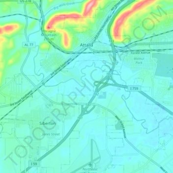
Name: Attalla topographic map, elevation, terrain.
Location: Attalla, Etowah County, Alabama, United States (33.96810 -86.13951 34.04048 -86.06563)
Average elevation: 577 ft
Minimum elevation: 499 ft
Maximum elevation: 988 ft
Etowah County trails, hiking, mountain biking, running and outdoor activities
Other topographic maps
Click on a map to view its topography, its elevation and its terrain.