
Fort Klamath topographic map
Click on the map to display elevation.
About this map
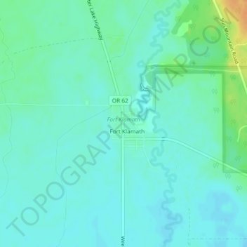
Name: Fort Klamath topographic map, elevation, terrain.
Location: Fort Klamath, Klamath County, Oregon, United States (42.69723 -121.99749 42.70792 -121.99007)
Average elevation: 4,177 ft
Minimum elevation: 4,150 ft
Maximum elevation: 4,262 ft
Klamath County trails, hiking, mountain biking, running and outdoor activities
Other topographic maps
Click on a map to view its topography, its elevation and its terrain.
Mount Scott
United States > Oregon > Klamath County
There is one trail to the summit of Mount Scott. Starting on Rim Drive, the trail is about 2.5 miles (4.0 km) long. It has many switchbacks, and ends at the fire lookout tower on the summit. The trailhead is at an elevation of 7,683 feet (2,342 m), and the trail climbs approximately 1,479 feet (451 m) to the…
Average elevation: 7,530 ft
Merrill
United States > Oregon > Klamath County
Merrill is at an elevation of 4,071 feet (1,241 m) in southern Klamath County, near the Oregon–California border. It is along Oregon Route 39 southeast of Klamath Falls and northwest of Tulelake. Lower Klamath Lake and Tule Lake, both in California, are slightly south of Merrill. By highway, the city is 20…
Average elevation: 4,072 ft
Malin
United States > Oregon > Klamath County
Malin is at an elevation of 4,062 feet (1,238 m) in southern Klamath County near the Oregon–California border. It is along a spur of Oregon Route 39, southeast of Klamath Falls, east of Merrill, and northeast of Tulelake. Lava Beds National Monument is to the south, nearby in California. By highway, the city…
Average elevation: 4,072 ft