Geolocate

Merrill topographic map

Interactive map

Click on the map to display elevation.

Merrill

Merrill is at an elevation of 4,071 feet (1,241 m) in southern Klamath County, near the Oregon–California border. It is along Oregon Route 39 southeast of Klamath Falls and northwest of Tulelake. Lower Klamath Lake and Tule Lake, both in California, are slightly south of Merrill. By highway, the city is 20 miles (32 km) from Klamath Falls and 300 miles (480 km) from Portland.

Wikipedia (CC-BY-SA 3.0)

About this map

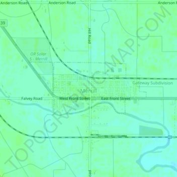
Name: Merrill topographic map, elevation, terrain.

Location: Merrill, Klamath County, Oregon, United States (42.02142 -121.61291 42.02954 -121.58868)

Average elevation: 4,072 ft

Minimum elevation: 4,055 ft

Maximum elevation: 4,081 ft

Klamath County trails, hiking, mountain biking, running and outdoor activities

Other topographic maps

Click on a map to view its topography, its elevation and its terrain.

Gilchrist

United States > Oregon > Klamath County

Average elevation: 4,580 ft

Mount Mazama

United States > Oregon > Klamath County

Mount Mazama (Tum-sum-ne in the Native American language Klamath) is a complex volcano in the western U.S. state of Oregon, in a segment of the Cascade Volcanic Arc and Cascade Range. The volcano is in Klamath County, in the southern Cascades, 60 miles (97 km) north of the Oregon–California border. Its…

Average elevation: 6,168 ft

Wizard Island

United States > Oregon > Klamath County

Average elevation: 6,243 ft

Saddle Mountain

United States > Oregon > Klamath County

Average elevation: 5,768 ft

Rock Point

United States > Oregon > Klamath County

Average elevation: 4,642 ft

Altamont

United States > Oregon > Klamath County

Average elevation: 4,298 ft

Chemult

United States > Oregon > Klamath County

Average elevation: 4,856 ft

Fort Klamath

United States > Oregon > Klamath County

Average elevation: 4,177 ft

Crescent

United States > Oregon > Klamath County

Average elevation: 4,557 ft

Mount Scott

United States > Oregon > Klamath County

There is one trail to the summit of Mount Scott. Starting on Rim Drive, the trail is about 2.5 miles (4.0 km) long. It has many switchbacks, and ends at the fire lookout tower on the summit. The trailhead is at an elevation of 7,683 feet (2,342 m), and the trail climbs approximately 1,479 feet (451 m) to the…

Average elevation: 7,530 ft

Odell Lake

United States > Oregon > Klamath County > Odell Lake

Average elevation: 4,895 ft

Beatty

United States > Oregon > Klamath County

Average elevation: 4,364 ft