
西夏区 topographic map
Interactive map
Click on the map to display elevation.
About this map
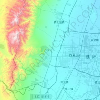
Name: 西夏区 topographic map, elevation, terrain.
Location: 西夏区, 银川市, 宁夏回族自治区, 750021, 中国 (38.31238 105.83883 38.71016 106.21805)
Average elevation: 4,711 ft
Minimum elevation: 3,615 ft
Maximum elevation: 10,443 ft
Other topographic maps
Click on a map to view its topography, its elevation and its terrain.