
兴泾镇 topographic map
Interactive map
Click on the map to display elevation.
About this map
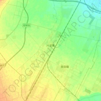
Name: 兴泾镇 topographic map, elevation, terrain.
Location: 兴泾镇, 西夏区, 银川市, 宁夏回族自治区, 中国 (38.31238 106.03491 38.44104 106.13892)
Average elevation: 3,688 ft
Minimum elevation: 3,642 ft
Maximum elevation: 3,737 ft
Other topographic maps
Click on a map to view its topography, its elevation and its terrain.