
会泽县 topographic map
Interactive map
Click on the map to display elevation.
About this map
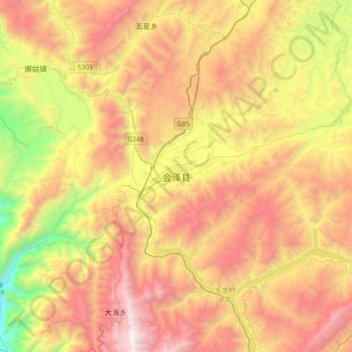
Name: 会泽县 topographic map, elevation, terrain.
Location: 会泽县, 曲靖市, 云南省, 中国 (26.25647 103.13075 26.57647 103.45075)
Average elevation: 7,697 ft
Minimum elevation: 3,337 ft
Maximum elevation: 12,077 ft
Other topographic maps
Click on a map to view its topography, its elevation and its terrain.