
大井镇 topographic map
Interactive map
Click on the map to display elevation.
About this map
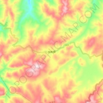
Name: 大井镇 topographic map, elevation, terrain.
Location: 大井镇, 会泽县, 曲靖市, 云南省, 中国 (26.43410 103.78300 26.51410 103.86300)
Average elevation: 6,841 ft
Minimum elevation: 5,919 ft
Maximum elevation: 7,608 ft
Other topographic maps
Click on a map to view its topography, its elevation and its terrain.