
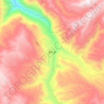
老厂乡 topographic map
Interactive map
Click on the map to display elevation.
About this map
Name: 老厂乡 topographic map, elevation, terrain.
Location: 老厂乡, 会泽县, 曲靖市, 云南省, 中国 (26.55723 103.12935 26.63723 103.20935)
Average elevation: 8,071 ft
Minimum elevation: 4,744 ft
Maximum elevation: 9,934 ft
Other topographic maps
Click on a map to view its topography, its elevation and its terrain.