
李俊乡 topographic map
Interactive map
Click on the map to display elevation.
About this map
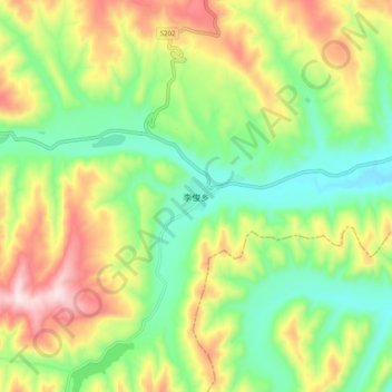
Name: 李俊乡 topographic map, elevation, terrain.
Location: 李俊乡, 海原县, 中卫市, 宁夏回族自治区, 中国 (36.18880 105.83700 36.26880 105.91700)
Average elevation: 6,184 ft
Minimum elevation: 5,564 ft
Maximum elevation: 7,136 ft
Other topographic maps
Click on a map to view its topography, its elevation and its terrain.