
沙溪镇 topographic map
Interactive map
Click on the map to display elevation.
About this map
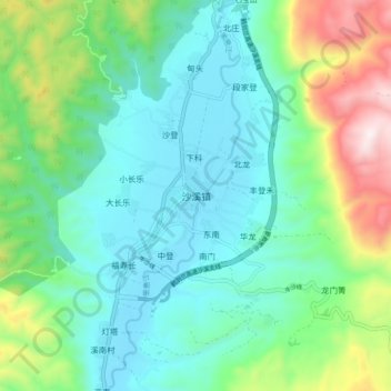
Name: 沙溪镇 topographic map, elevation, terrain.
Location: 沙溪镇, 剑川县, 大理白族自治州, 云南省, 671302, 中国 (26.27955 99.81198 26.35955 99.89198)
Average elevation: 7,595 ft
Minimum elevation: 6,854 ft
Maximum elevation: 9,754 ft
Other topographic maps
Click on a map to view its topography, its elevation and its terrain.