
老君山镇 topographic map
Interactive map
Click on the map to display elevation.
About this map
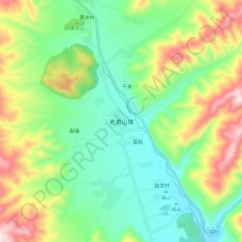
Name: 老君山镇 topographic map, elevation, terrain.
Location: 老君山镇, 剑川县, 大理白族自治州, 云南省, 中国 (26.50000 99.54134 26.58000 99.62134)
Average elevation: 8,507 ft
Minimum elevation: 7,766 ft
Maximum elevation: 9,911 ft
Other topographic maps
Click on a map to view its topography, its elevation and its terrain.