Geolocate

塘坊镇 topographic map

Interactive map

Click on the map to display elevation.

About this map

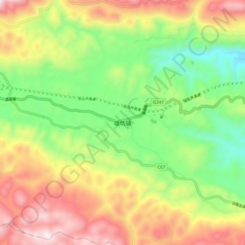
Name: 塘坊镇 topographic map, elevation, terrain.

Location: 塘坊镇, 巫溪县, 重庆市, 中国 (31.35172 109.27623 31.43172 109.35623)

Average elevation: 3,225 ft

Minimum elevation: 1,729 ft

Maximum elevation: 5,112 ft

Other topographic maps

Click on a map to view its topography, its elevation and its terrain.

通城镇

中国 > 重庆市 > 巫溪县

通城镇, 巫溪县, 重庆市, 中国

Average elevation: 3,875 ft

双阳乡

中国 > 重庆市 > 巫溪县

双阳乡, 巫溪县, 重庆市, 中国

Average elevation: 5,020 ft

上磺镇

中国 > 重庆市 > 巫溪县

上磺镇, 巫溪县, 重庆市, 中国

Average elevation: 3,035 ft

兰英乡

中国 > 重庆市 > 巫溪县

兰英乡, 巫溪县, 重庆市, 中国

Average elevation: 4,281 ft

巫溪县

中国 > 重庆市 > 巫溪县 > 柏杨街道

巫溪县, 柏杨街道, 巫溪县, 渝东北三峡库区城镇群, 重庆市, 中国

Average elevation: 3,228 ft