
襄都区 topographic map
Interactive map
Click on the map to display elevation.
About this map
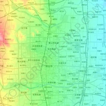
Name: 襄都区 topographic map, elevation, terrain.
Location: 襄都区, 邢台市, 河北省, 054000, 中国 (36.99091 114.47707 37.17796 114.63849)
Average elevation: 243 ft
Minimum elevation: 148 ft
Maximum elevation: 509 ft
Other topographic maps
Click on a map to view its topography, its elevation and its terrain.