
临城县 topographic map
Interactive map
Click on the map to display elevation.
About this map
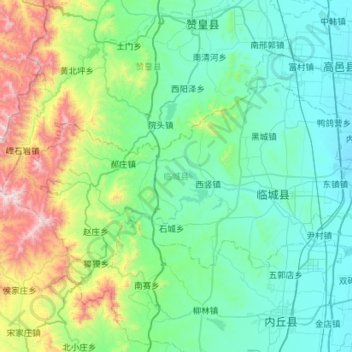
Name: 临城县 topographic map, elevation, terrain.
Location: 临城县, 邢台市, 河北省, 054000, 中国 (37.34708 114.06160 37.58327 114.62617)
Average elevation: 1,027 ft
Minimum elevation: 125 ft
Maximum elevation: 4,836 ft
Other topographic maps
Click on a map to view its topography, its elevation and its terrain.