
Oregon topographic map
Click on the map to display elevation.
Oregon
Perhaps the most well-known attraction in Oregon is the Sundance Drive-In, one of the last in the region. Pearson Metropark, within the city limits, and Maumee Bay State Park, have preserved or re-created sections of the original Black Swamp topography and forest. The state park also offers a waterfront resort off Lake Erie, and features a links golf course that has held numerous U.S. Open local qualifiers. Its location at the confluence of major migration routes brings birdwatchers and hunters to nearby shoreland areas. Boating and fishing on Lake Erie are popular pursuits. The city sponsors an extensive softball and baseball recreation program. The annual ethnic German American festival draws over 30,000 people each year.
About this map
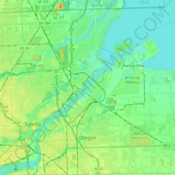
Name: Oregon topographic map, elevation, terrain.
Location: Oregon, Lucas County, Ohio, United States (41.61785 -83.50647 41.73845 -83.37090)
Average elevation: 597 ft
Minimum elevation: 558 ft
Maximum elevation: 673 ft
Lucas County trails, hiking, mountain biking, running and outdoor activities
Other topographic maps
Click on a map to view its topography, its elevation and its terrain.