
Oak Park Heights topographic map
Interactive map
Click on the map to display elevation.
About this map
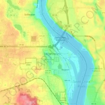
Name: Oak Park Heights topographic map, elevation, terrain.
Average elevation: 843 ft
Minimum elevation: 666 ft
Maximum elevation: 1,093 ft
Washington County trails, hiking, mountain biking, running and outdoor activities
Other topographic maps
Click on a map to view its topography, its elevation and its terrain.
Grey Cloud Island
United States > Minnesota > Washington County > Grey Cloud Island Township
Average elevation: 738 ft
Cottage Grove
United States > Minnesota > Washington County > Cottage Grove > Cottage Grove
Average elevation: 850 ft