Geolocate

Turley topographic map

Click on the map to display elevation.

About this map

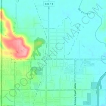
Name: Turley topographic map, elevation, terrain.

Location: Turley, Tulsa County, Oklahoma, 74130, United States (36.23502 -95.99553 36.26999 -95.93390)

Average elevation: 656 ft

Minimum elevation: 584 ft

Maximum elevation: 955 ft

Tulsa County trails, hiking, mountain biking, running and outdoor activities

Other topographic maps

Click on a map to view its topography, its elevation and its terrain.

Sperry

United States > Oklahoma > Tulsa County

Average elevation: 627 ft

Tulsa

United States > Oklahoma > Tulsa County > Tulsa

Average elevation: 722 ft

Owasso

United States > Oklahoma > Tulsa County > Owasso > Owasso

Average elevation: 633 ft

Terrace Park

United States > Oklahoma > Tulsa County > Tulsa

Average elevation: 735 ft

Mingo

United States > Oklahoma > Tulsa County > Tulsa

Average elevation: 607 ft

Gear up for your next adventure:

🕶️Glacier Sunglasses - Side shields to protect eyes from high-altitude snow glare
🪑Ultralight Camp Chairs - Portable seating for resting after a long day of mapping
📦Dry Bags Set - Waterproof storage for electronics and clothes
GPS Sports Watch - GPS watch for running, hiking and training
🛰️Satellite Messengers - Emergency SOS and two-way messaging for off-grid adventures

As an Amazon Associate, this site earns from qualifying purchases at no extra cost to you.