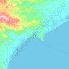
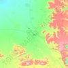
Ibb Governorate topographic map
Click on the map to display elevation.
About this map
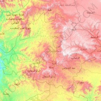
Name: Ibb Governorate topographic map, elevation, terrain.
Location: Ibb Governorate, Yemen (13.70495 43.65166 14.46559 44.68149)
Average elevation: 5,633 ft
Minimum elevation: 1,371 ft
Maximum elevation: 10,604 ft
Other topographic maps
Click on a map to view its topography, its elevation and its terrain.
Ta'izz
Taiz (Arabic: تَعِزّ, romanized: Taʿizz) is a city in southwestern Yemen. It is located in the Yemeni highlands, near the port city of Mocha on the Red Sea, at an elevation of about 1,400 metres (4,600 ft) above sea level. It is the capital of Taiz Governorate. As of 2023, the city has an estimated…
Average elevation: 4,646 ft


Sana'a
At an elevation of 2,300 metres (7,500 ft), Sanaa is one of the highest capital cities in the world and is next to the Sarawat Mountains of Jabal An-Nabi Shu'ayb and Jabal Tiyal, considered to be the highest mountains in the country and amongst the highest in the region. Sanaa has a population of approximately…
Average elevation: 8,015 ft
Ta'izz
Taiz (Arabic: تَعِزّ, romanized: Taʿizz) is a city in southwestern Yemen. It is located in the Yemeni highlands, near the port city of Mocha on the Red Sea, at an elevation of about 1,400 metres (4,600 ft) above sea level. It is the capital of Taiz Governorate. As of 2023, the city has an estimated…
Average elevation: 4,646 ft


`Ozlat Bani Shibah al Gharb
Yemen > Ta'izz Governorate > `Arsh > Al `Amqa'
Average elevation: 4,131 ft

قصر/ النقيب محمد علي درهم الشايف
Yemen > Al Jawf Governorate > Rajuzah > Al Hijrah
Average elevation: 6,847 ft


Rada`
Rada'a is one of the cities of the Republic of Yemen. It is situated in the southeastern region of the capital city of Sana'a, approximately 150 kilometers away from it, at an elevation of approximately 2100 meters above sea level. Geographically, Rada'a belongs to the Al-Bayda governorate. It is situated…
Average elevation: 7,031 ft


Ta'izz
Taiz (Arabic: تَعِزّ, romanized: Taʿizz) is a city in southwestern Yemen. It is located in the Yemeni highlands, near the port city of Mocha on the Red Sea, at an elevation of about 1,400 metres (4,600 ft) above sea level. It is the capital of Taiz Governorate. As of 2023, the city has an estimated…
Average elevation: 4,646 ft


Ibb
Ibb is located at an altitude of 2,050 metres (6,730 ft) on a spur of Mount Shamāḥī. Due to its high altitude, Ibb has a dry-winter humid subtropical climate (Köppen climate classification: Cwa), and is one of the wettest areas of Yemen, typically receiving around 500 mm of rain per annum.
Average elevation: 6,903 ft






Al Bayda
Al Bayda' has a cool semi-arid climate (Köppen BSk). The summer season has very warm afternoons and cool mornings, whilst in the winter afternoons are warm but with the clear skies and high altitude mornings are chilly and frosts are not uncommon. More than half of the approximately 400 millimetres or 16…
Average elevation: 6,693 ft
Ta'izz
Taiz (Arabic: تَعِزّ, romanized: Taʿizz) is a city in southwestern Yemen. It is located in the Yemeni highlands, near the port city of Mocha on the Red Sea, at an elevation of about 1,400 metres (4,600 ft) above sea level. It is the capital of Taiz Governorate. As of 2023, the city has an estimated…
Average elevation: 4,646 ft


`Ozlat Jabal ad Dar
Yemen > Dhamar Governorate > Al Qaryah as Sufla > غول الضباء
Average elevation: 8,406 ft



Sana'a
At an elevation of 2,300 metres (7,500 ft),[4] Sanaa is one of the highest capital cities in the world and is next to the Sarawat Mountains of Jabal An-Nabi Shu'ayb and Jabal Tiyal, considered to be the highest mountains in the country and amongst the highest in the region. Sanaa has a population of…
Average elevation: 8,015 ft