
永和街道 topographic map
Interactive map
Click on the map to display elevation.
About this map
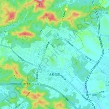
Name: 永和街道 topographic map, elevation, terrain.
Location: 永和街道, 黄埔区, 广州市, 广东省, 中国 (23.17042 113.50609 23.24730 113.58313)
Average elevation: 272 ft
Minimum elevation: 10 ft
Maximum elevation: 1,276 ft
Other topographic maps
Click on a map to view its topography, its elevation and its terrain.