
黄埔区 topographic map
Interactive map
Click on the map to display elevation.
About this map
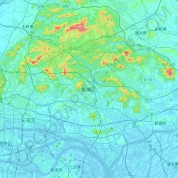
Name: 黄埔区 topographic map, elevation, terrain.
Location: 黄埔区, 广州市, 广东省, 510530, 中国 (23.02245 113.31609 23.34245 113.63609)
Average elevation: 157 ft
Minimum elevation: -39 ft
Maximum elevation: 1,663 ft
Other topographic maps
Click on a map to view its topography, its elevation and its terrain.