
尖峰岭公园 topographic map
Interactive map
Click on the map to display elevation.
About this map
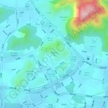
Name: 尖峰岭公园 topographic map, elevation, terrain.
Location: 尖峰岭公园, 联和街道, 黄埔区, 广州市, 广东省, 中国 (23.17225 113.44189 23.18015 113.45101)
Average elevation: 180 ft
Minimum elevation: 39 ft
Maximum elevation: 889 ft
Other topographic maps
Click on a map to view its topography, its elevation and its terrain.