
Ice topographic map
Click on the map to display elevation.
About this map
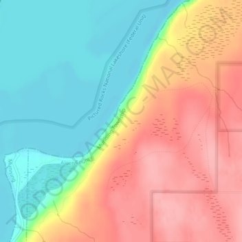
Name: Ice topographic map, elevation, terrain.
Location: Ice, Alger County, Michigan, United States (46.45668 -86.58963 46.45678 -86.58953)
Average elevation: 741 ft
Minimum elevation: 571 ft
Maximum elevation: 928 ft
Other topographic maps
Click on a map to view its topography, its elevation and its terrain.
Grand Island
United States > Michigan > Alger County > Grand Island Township
Average elevation: 646 ft
Pictured Rocks National Lakeshore (Federal Unit)
United States > Michigan > Alger County > Burt Township
Average elevation: 741 ft
Pictured Rocks National Lakeshore (Inner Buffer Zone)
United States > Michigan > Alger County > Munising Township
Average elevation: 722 ft