Geolocate

樊城区 topographic map

Interactive map

Click on the map to display elevation.

About this map

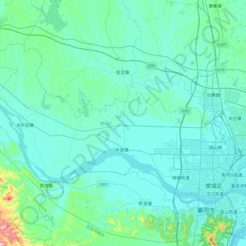
Name: 樊城区 topographic map, elevation, terrain.

Location: 樊城区, 襄阳市, 湖北省, 441000, 中国 (32.02059 111.74500 32.25462 112.17011)

Average elevation: 354 ft

Minimum elevation: 171 ft

Maximum elevation: 1,962 ft

Other topographic maps

Click on a map to view its topography, its elevation and its terrain.

襄阳市银河运动公园

中国 > 湖北省 > 襄阳市

襄阳市银河运动公园, 鑫利达小区, 王寨街道, 樊城区, 襄阳市, 湖北省, 中国

Average elevation: 226 ft

洪山咀

中国 > 湖北省 > 襄阳市

洪山咀, 襄阳市, 湖北省, 中国

Average elevation: 358 ft

团山镇

中国 > 湖北省 > 襄阳市

团山镇, 樊城区, 襄阳市, 湖北省, 中国

Average elevation: 246 ft

米庄镇

中国 > 湖北省 > 襄阳市

米庄镇, 襄州区, 襄阳市, 湖北省, 中国

Average elevation: 282 ft

高新区汉江国投运动公园

中国 > 湖北省 > 襄阳市 > 米庄镇

高新区汉江国投运动公园, 富康园, 米庄镇, 襄州区, 襄阳市, 湖北省, 中国

Average elevation: 276 ft

肖湾街道

中国 > 湖北省 > 襄阳市

肖湾街道, 襄州区, 襄阳市, 湖北省, 中国

Average elevation: 259 ft

襄州区

中国 > 湖北省 > 襄阳市

襄州区, 襄阳市, 湖北省, 中国

Average elevation: 344 ft

谷城县

中国 > 湖北省 > 襄阳市

谷城县, 襄阳市, 湖北省, 中国

Average elevation: 1,273 ft

张湾街道

中国 > 湖北省 > 襄阳市

张湾街道, 襄州区, 襄阳市, 湖北省, 441123, 中国

Average elevation: 230 ft

襄阳市

中国 > 湖北省 > 襄阳市

襄阳市, 襄城区, 襄阳市, 湖北省, 441021, 中国

Average elevation: 299 ft

老河口市

中国 > 湖北省 > 襄阳市

老河口市, 襄阳市, 湖北省, 中国

Average elevation: 446 ft