
米庄镇 topographic map
Interactive map
Click on the map to display elevation.
About this map
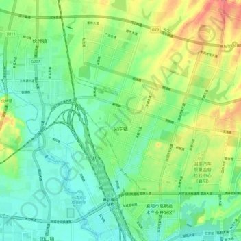
Name: 米庄镇 topographic map, elevation, terrain.
Location: 米庄镇, 襄州区, 襄阳市, 湖北省, 中国 (32.10154 112.12283 32.19511 112.22365)
Average elevation: 282 ft
Minimum elevation: 203 ft
Maximum elevation: 430 ft
Other topographic maps
Click on a map to view its topography, its elevation and its terrain.