
Make a donation
Gear up for your next adventure:
As an Amazon Associate, this site earns from qualifying purchases at no extra cost to you.
Doorn topographic map
Click on the map to display elevation.
Make a donation
Gear up for your next adventure:
As an Amazon Associate, this site earns from qualifying purchases at no extra cost to you.
About this map
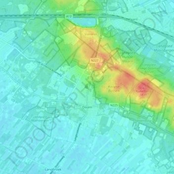
Name: Doorn topographic map, elevation, terrain.
Location: Doorn, Utrechtse Heuvelrug, Utrecht, Nederland (52.01004 5.29176 52.07077 5.39200)
Average elevation: 46 ft
Minimum elevation: 7 ft
Maximum elevation: 203 ft
Make a donation
Gear up for your next adventure:
As an Amazon Associate, this site earns from qualifying purchases at no extra cost to you.
Other topographic maps
Click on a map to view its topography, its elevation and its terrain.
Make a donation
Gear up for your next adventure:
As an Amazon Associate, this site earns from qualifying purchases at no extra cost to you.
Ameide
Naast evenementen op regelmatige basis vinden er ook andere activiteiten plaats. Ook in de directe omgeving en in de regio wordt veel georganiseerd, waarbij met name Salmsteke, op de noordoever van de Lek ter hoogte van Ameide, een belangrijk evenemententerrein is.
Average elevation: 0 ft
Make a donation
Gear up for your next adventure:
As an Amazon Associate, this site earns from qualifying purchases at no extra cost to you.
Make a donation
Gear up for your next adventure:
As an Amazon Associate, this site earns from qualifying purchases at no extra cost to you.
Make a donation
Gear up for your next adventure:
As an Amazon Associate, this site earns from qualifying purchases at no extra cost to you.
Grebbeberg
Topografisch kaartbeeld van de Grebbeberg en de Blauwe Kamer, december 2015. Klik voor een vergroting.
Average elevation: 52 ft
Make a donation
Gear up for your next adventure:
As an Amazon Associate, this site earns from qualifying purchases at no extra cost to you.
Driebergen-Rijsenburg
Nederland > Utrecht > Driebergen-Rijsenburg > Driebergen-Rijsenburg
Average elevation: 30 ft
Make a donation
Gear up for your next adventure:
As an Amazon Associate, this site earns from qualifying purchases at no extra cost to you.
Make a donation
Gear up for your next adventure:
As an Amazon Associate, this site earns from qualifying purchases at no extra cost to you.
Make a donation
Gear up for your next adventure:
As an Amazon Associate, this site earns from qualifying purchases at no extra cost to you.
Make a donation
Gear up for your next adventure:
As an Amazon Associate, this site earns from qualifying purchases at no extra cost to you.
Make a donation
Gear up for your next adventure:
As an Amazon Associate, this site earns from qualifying purchases at no extra cost to you.
Make a donation
Gear up for your next adventure:
As an Amazon Associate, this site earns from qualifying purchases at no extra cost to you.
Cattenbroek
Nederland > Utrecht > Linschoten > Cattenbroek
Bij Woerden gaat de Cattenbroekerdijk middels een viaduct over de A12. Een deel van de oorspronkelijke dijk is nog te zien naast de oprit die toegang geeft tot het viaduct, ter hoogte van Cattenbroekerdijk 18. Bij Montfoort loopt de dijk langs de Montfoortse Vaart.
Average elevation: 0 ft
Make a donation
Gear up for your next adventure:
As an Amazon Associate, this site earns from qualifying purchases at no extra cost to you.