Geolocate

Kota Setar topographic map

Click on the map to display elevation.

About this map

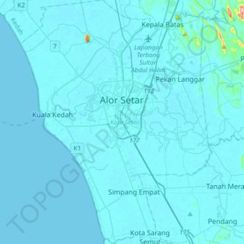
Name: Kota Setar topographic map, elevation, terrain.

Location: Kota Setar, Kedah, Malaysia (5.96821 100.25850 6.23066 100.46646)

Average elevation: 16 ft

Minimum elevation: -3 ft

Maximum elevation: 702 ft

Other topographic maps

Click on a map to view its topography, its elevation and its terrain.

Bukit Payong

Malaysia > Kedah > Jitra

Average elevation: 525 ft

Melaka River

Malaysia > Kedah > Kampung Padang Gaong

Average elevation: 59 ft

Serdang

Malaysia > Kedah

Average elevation: 184 ft

Mata Ayer

Malaysia > Kedah

Average elevation: 184 ft

Kampung Seberang

Malaysia > Kedah > Jitra

Average elevation: 30 ft

Kampung Tok Weng

Malaysia > Kedah > Baling

Average elevation: 377 ft

Sungai Lalang

Malaysia > Kedah > Sungai Lalang

Average elevation: 39 ft

Sungai Kupang

Malaysia > Kedah > Kupang

Average elevation: 233 ft

Bukit Goh Lembu

Malaysia > Kedah

Average elevation: 745 ft

Permatang Kerat Telunjuk

Malaysia > Kedah

Average elevation: 105 ft

Kampung Tanjung Putus

Malaysia > Kedah

Average elevation: 95 ft

Sungai Layar Hujung

Malaysia > Kedah > Sungai Petani

Average elevation: 13 ft

Kampung Bakar Bata

Malaysia > Kedah > Alor Setar

Average elevation: 16 ft

Kampung Bohor

Malaysia > Kedah

Average elevation: 13 ft

Titi Hayun

Malaysia > Kedah

Average elevation: 761 ft

Semeling

Malaysia > Kedah

Average elevation: 82 ft

Kampung Batin

Malaysia > Kedah > Alor Setar > Kampung Batin

Average elevation: 13 ft

Kampung Khatijah

Malaysia > Kedah > Alor Setar > Kampung Khatijah

Average elevation: 16 ft

Jeniang

Malaysia > Kedah > Jeniang

Average elevation: 190 ft

Sungai Sedim

Malaysia > Kedah

Average elevation: 82 ft

Baling

Malaysia > Kedah

Average elevation: 436 ft

Kampung Buloh Lima

Malaysia > Kedah > Kampung Buloh Lima

Average elevation: 13 ft

Sungai Sedim

Malaysia > Kedah > Kampung Badang

Average elevation: 266 ft

Kerian River

Malaysia > Kedah

Average elevation: 10 ft

Gear up for your next adventure:

Backpacking Tents - Weight-optimized shelters for multi-day topographic surveys
🥾Hiking Shoes - Durable and comfortable shoes for trail hiking
🧷Carabiner Set - Durable clips for gear attachment
🌲Outdoor Survival Books - Best books on survival skills
🖼️Topo Map Wall Art - Decorative topographic prints of famous peaks and regions

As an Amazon Associate, this site earns from qualifying purchases at no extra cost to you.